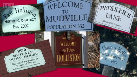
What's in a Name?
A Guide to 19 of the Named Regions of Holliston
There is a wonderful curiosity in the air these days about the layout of town. It is a renewed interest in monikers previously reserved for townies. For beneath the map of Holliston that you find on GoogleMaps, there is a map that is rooted in local lore. It consists of neighborhood names that have been passed down from generation to generation. It is neither formal nor consistent. Over the years, more than 15 different areas of Holliston have been given special names. If we were a city, I suppose they’d be called burroughs; but we’re not, so they’re just called "that part of town". Some we hear on a regular basis such as Mudville. Others we would only hear if we hung out at The Grill or Central Cafe for our morning coffee.
The origins of most of the names are rooted in the geography, some were given by the original developers, and some seem to be complete non-sequiturs. Though the names successfully stood the test of time, the actual boundaries have been at the mercy of an intergenerational game of Telephone. Families had different ideas, memories faded, and so definitions became blurred. Even the experienced townie gets a bit reluctant to define boundaries.
I sat down with two such townies recently to try to map it all out: Carl Damigella and Bobby Blair. Both Townies with a capital "T". Carl has 20+ years on the Fire Department, 15 years as a Selectman, countless years on elected and appointed boards and committees. And, Bobby has an equally impressive town resume and he is, after all, The Mayor of Mudville. Surely they both know the lay of the land. Could the two of them agree on every boundary? Absolutely not. And, even when they could agree, they would look at each other and say, "Oh, Joanne is going to take us to town on this one" (referring, of course, to Joanne Hulbert our official Town Historian and another schoolmate of theirs at Holliston High).
Before defining the different areas, there are a few caveats: First, areas are very general. As I said, definitions change from generation to generation and from family to family. Second, regions are a snapshot of time. New homes in an older area may not, by most, be considered part of that burrow. A newer home may be in a region but not part of the region.
If you want to test your town knowledge, look first at the blank map – Parts of Town - I suggest right-clicking and opening in a new tab so you have it for reference. (Unfortunately, due to the size of the map file, I can’t put it in stream. The PDF has the best resolution anyway, so it is worth the click). How many areas can you successful identify? Leave a comment and let me know. If you can name more than five, you’re probably a townie.
So, let’s start with the best known area … Mudville.
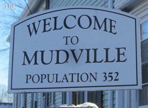
A) Mudville: With much discussion about the boundaries, Bobby defined Mudville as Winthrop Street to Central Street (not including Central) to Washington (not including Washington) to Pleasant Street. Carl, having grown up on Exchange, suggested that Mudville ended at the tracks. Bobby pulled The Mayor card and the discussion was over.
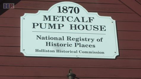
B) Metcalf: Washington Street from Post Office to Underwood Street and Summer Street to the Medway town line. The portion on Summer Street just before Mission Springs was referred to as Metcalf Station because that was the train stop on Summer.
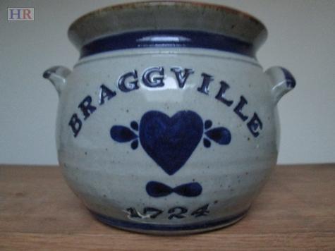
C) Braggville: For being a lesser known region, it covers a lot of land. Braggville consists of Washington from Weston Pond to the Milford town line. South Street from Washington to the Medway town line including Rockland & Fisher Streets. Adams Street from Washington Street to Marshall Street. Marshall Street from Adams to Courtland and all of Courtland Street. The Braggville Station was down on South Street by the tracks. Note: Newer homes in this area would be considered in the Braggville area but not part of Braggville. A subtle distinction that relates to the fact that the naming is part of a snapshot in time.
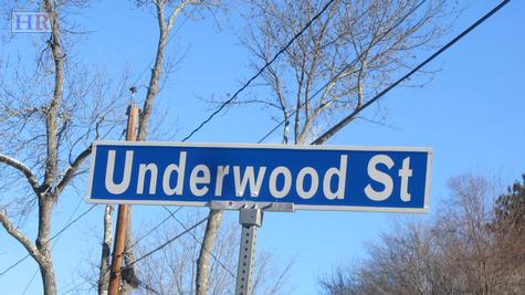
D) Dog Corner: Bobby needed to Phone-a-Friend on this one. He verified his definition with his father, so accuracy is indisputable. It is the corner of Washington Street and Underwood Street.
E) Holly Hill: Norfolk Street from roughly the tension wires to the Medway town line. The entire length of Goulding Street and Holly Lane and all of the cross streets in that development.
F) Strawberry Hill: Norfolk Street from Cold Spring to Arcadian Farm. The development surrounding Cold Spring Road, Shaw Farm Road, Appleyard Lane, and all the small roads in that neighborhood.
G) Nob Hill: A delightful neighborhood that I never realized had a name. It is the area off Central Street that includes SkyView, Donna, Beverly Circle, Byron, and Rich Road but not Mitchell Road.
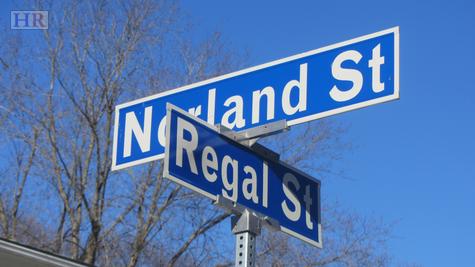
H) The Orchards: The neighborhood consisting of Norland Street and Regal Street and a small part of Lowland and Woodland Streets. Home of the best neighborhood Christmas display in town thanks to the dedication of Mr Richard Ball.
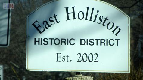
I) East Holliston: A difficult area to nail down. Starting on Washington Street somewhere between Linden and Winter Street, East Holliston runs down Washington Street to the Sherborn town line. The area encompasses part of Concord Street, High Street, Locust Street, and Brook Sreett. The East Holliston Station is the little newly renovated house right on the tracks at Washington & Whitney Street. (Note the distinction between East Holliston & East Holliston Historic District)
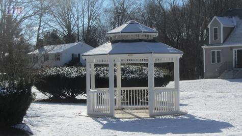
J) Gooch’s Corner: Made popular by the new gazebo, Gooch’s Corner sits at the intersection of Ashland Street and Concord Street.
K) The West End: I love that name. It is the entire length of Mill Street, Prentice Street from Mill to the Hopkinton town line. The first part of Marshall Street from Prentice to roughly Gorwin Drive. Adams from roughly Gorwin Drive Ext to Hanlon Street. And all of Hanlon Street. Also, including Highland Street from roughly Hollis Street to the Ashland town line.
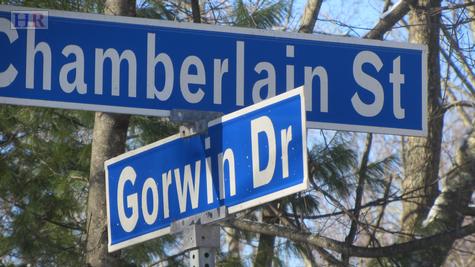
L) Brentwood: This is an area that varies quite a bit from person to person. At the start, the original model homes for Brentwood were on Underwood just before the curve that is now Kim Place. That is where Brentwood starts. It then covers the full length of Chamberlain Street until roughly the curve just after Jerrold Street. Gorwin Drive from the top down to Karen Circle (this lower boundary seems to vary quite a bit). Andrew Lane, Jerrold Street, Ridge Road and all the neighborhood streets in that region.
M) Harvestdale: This is the neighborhood inside of Highland, Prospect Street, and Washington Street but not including Highland, Prospect and Washington. It includes Wilkins Road, Calrton Drive, Pearl Street, the first part of Marked Tree, Webster Drive, and the other little streets in that area.

N) Phipps Hill: Thanks to Bobby, this area name is getting resurrected as common place. This is the hill leading up Washington Street from Marked Tree Road to the Highland Street lights. It is also the hill that the tunnel runs through under Highland Street. The Phipps Hill area can be considered that short stretch of Washington and Highland Street from the lights to Lake Grove.
O) The Queens: Probably the best known area, the Queens is the neighborhood located inside Winter Street, Maple Street, Ashland Street, and Concord Street. Though there are a few Queens homes on Winter Street, Winter is not considered part of the Queens.
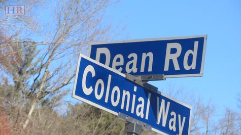
Also, a very small pocket starting at Colonial Way is not really part of the Queens. It includes Brookview Road and Colonial Way, Dean Road and Travis Road on the Concord Street side of Brookview Road.
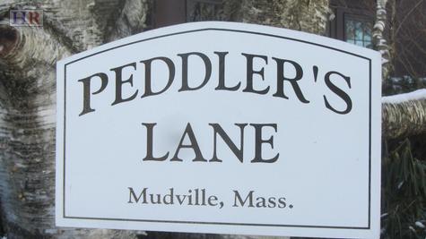
P) Peddler’s Lane: Part of Mudville, but specifically Mechanic Street from Pleasant Street to the dead end.
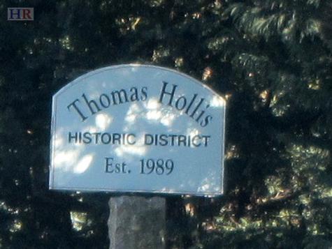
Q) Thomas Hollis Historic District: Washington from the top of Phipps Hill to Winter Street is considered a historic district though, people rarely use this designation when talking about parts of town.
R) East Holliston Historic District: There are two signs marking the boundaries of the East Holliston Historic District. One is at Curve Street just beyond Rossini Corner and the other is down by Locus Street. These mark the historic district running solely along Washington Street.
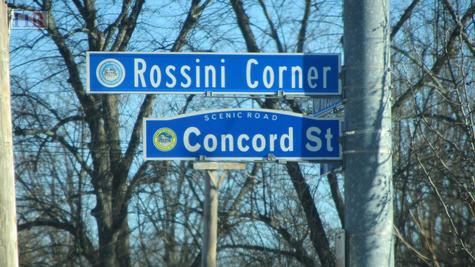
S) Rossini Corner: A notable gem in East Holliston is the intersection of Concord and Washington Streets. Some refer to it as the corner at Bertucci’s or the lights in East Holliston, but the proper naming is Rossini Corner.
It isn’t easy to keep it all straight. And, no doubt, there will be corrections. If you have a different definition of parts of town, please let me know. I’d love to hear how the intra-town lines vary. This is a place to start. Now, if someone happens to say that they live in Nob Hill, you’ll at least know they’re still part of Holliston.
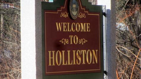
Where did Holliston come from?
We all know that Holliston was founded in 1724 and many know that Holliston was originally part of Sherborn. But, like any good family tree, our roots run beyond Sherborn. In fact, Holliston is a descendent of Dedham.
Dedham was founded in 1636. A short 13 years later, in 1649, part of Dedham seceded and called themselves Medfield. After a tumultuous time with conflicts between the settlers of Medfield & the Native Americans, Sherborn was formed in 1674. Finally, in 1720 the population of Sherborn had increased to the point where the town Meeting House was no longer large enough. A second Meeting House was in order. And so,
‘…a group of worthy men from the western part (of Sherborn) petitioned to be set off as a separate precinct so that they could build a church in a more convenient location. From an old record of Nov 18, 1723, “At said meeting the following motion was made by Sundry of ye Principal Inhabitants of ye said Town, Who are Dwellers of ye West side of Dopping Brook. The request of us the Subscribers in behalf of ourselves and the Other Western Inhabitants of ye Town; Do desire to be set off as a separate precinct.” The motion was passed in the Affirmative, “for the sake of Future Peace and Good Neighborhood.’
-Holliston, Massachusetts 250th Anniversary Commemorative Booklet
The bill was passed on December 3, 1724. The town was named HOLLISTON after Thomas Hollis, Esq. of London, a benefactor of Harvard College.
I’d say the mission of future peace and good neighborhood with Sherborn has proved to be successful.
Well across from Rossini Corner was also called Finn's corner. The family owned Finn's Mobil and the oil and excavation business Finn Bros. Holliston High School on Hollis Street, was once part of the Finn farm. The land was taken by eminent domain from the family.
Anne Lewis | 2016-08-15 06:48:20
Great article. I've done a bit of research about Sherborn history, there's good resources on-line including an excellent book written in 1848. I am a bit of a grammar cop so I can"t help myself sometimes. Two corrections: boroughs not burrows, and seceded on succeeded :-) Again, great job!!
Rick Shansky | 2016-08-14 04:45:13
Carl is right. Mudville stops at the railroad bridge on Exchange street but extends beyond the railroad at Arch Street. Bobby and Carl, you missed a big one: WARD FOUR ! ! ! That's east of the railroad on Elm and Central to Fiske, Franklin, Winthrop, Water, Vine, Norfolk to Franklin, Front and eastern Exchange. It may not sound as romantic as Mudville, but the area has a proud and illustrious history all its own and should be celebrated! . . . . And Cat Hill (at Washington and Summer streets) . . . . And how about Farquhar's Hill on Highland Street. . . . And Rocky Woods out at the West End and Braggville. . . . . Oh, the places we can go - in Holliston!
Joanne Hulbert | 2013-12-29 12:47:49
Nice idea and a good job Theresa. If I may add... My dad, Ed Hamlet, 96, and I often talk about these old areas of Town. He grew up in the house across from the Metcalf Fire Station, next door to the Bill Evans house of his era. I asked him from where did the name Phipps Hill originate. He didn't know, which goes to show the name arrived before his time. And, oh, you may not be aware of this ... Anna Farnsworth lived on Washington St. in the little house next to Kingsbury's. The area was called Anna Farnsworth's "corner" and was so named because of a sharp turn in the road, just after Anna's house. My dad recalls cars approaching the twist would often roll over. (If one looks hard, the turn can still be seen.) Later, this section of Washington St. was straightened as it remains today.
s.chipman | 2013-12-15 09:08:17
I love this post!
Allison | 2013-12-14 15:26:51
Wow, thank you Theresa for all that info - must have been fun with Carl and Bobby!! I was a 3rd grade teacher -retired 4 1/2 yrs ago)) and taught Holliston history. Love all the knowledge about the town - thanks.
Kathie | 2013-12-14 14:54:29
Thank you,Theresa, for educating us all.
Paul | 2013-12-14 14:38:38
HR - Thank you for bringing the article to life with your pictures. They are terrific!!
Theresa | 2013-12-14 12:40:24