Levels of Service and Travel Projections: The Wrong Tools for Planning Our Streets?
(image by Andy Singer)
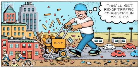
Levels of Service (LOS) is a performance metric which flourished during the interstate- and freeway-building era that went from the 1950s to the 1990s. Using a scale of A to F, LOS attempts to create an objective formula to answer a subjective question: How much congestion are we willing to tolerate? As in grade school, “F” is a failing grade and “A” is perfect.
Yet in search of high LOS rankings, transportation professionals have widened streets, added lanes, removed on-street parking, limited crosswalks, and deployed other inappropriate strategies. In ridding our communities of the weeds of congestion, we have also pulled out the very plants that made our “gardens” worthwhile in the first place.
Overdesigned roadways encourage motorists to drive at higher speeds, making them difficult to cross and unpleasant to walk along. This degrades public spaces between the edges of the road and the adjacent buildings, encourages people to drive short distances, and generally unravels a community’s social fabric.
The question that needs to be asked in urban settings is not whether you ever want to sit in congestion again. Who does? The question is whether you want to eliminate congestion on your Main Street 24 hours a day, 7 days a week, 365 days a year — knowing that the consequence would be a community with decimated economic and social value, increased reliance on car use, increased crashes, and, ultimately, more congestion.
Recognizing the need for balance, a number of entities are beginning to promote approaches sensitive to the context.
Design with the community in mind
It’s time for communities and transportation professionals alike to accept that we have been using the wrong tools for the wrong job. LOS and travel modeling may be effective when sizing and locating high-speed freeways, but are totally inappropriate in every other setting. If travel modeling with high rates of growth is used to make street decisions, your community may be doomed to a series of roadway widenings or intersection expansions. If vehicular LOS C or D performance measures are adopted as non-negotiable targets, major road construction will be heading your way.
Village, suburban and city streets need to be designed with the community in mind using the PPS principle of Streets as Places to create a vision for a great community and then plan your streets to support that vision.
Let's not be fooled by the appearance of science behind Levels of Service and Traffic Modeling. As I pointed out in an interview with Wayne Senville that was published in the November 2010 “Planning Commissioner’s Journal,” LOS standards are easy to understand — and that’s exactly what makes them so dangerous.
All images by Andy Singer.
Author: Gary Toth
The complete article can be found at: